
Driving the route
The route has a maximum speed of 15mph. Yards are limited to 5mph and station platforms to 10mph. Road crossings are also limited to 5mph.
All the points are manual.
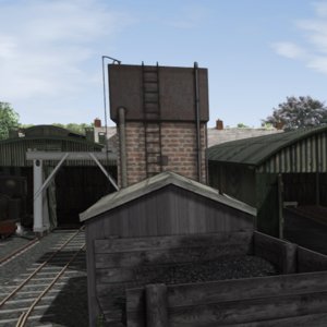
There is water available at Hulme End Platform and in Waterhouses Yard. Both coal and water are, of course, available at the Hulme End engine shed.
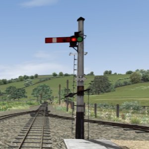
The route is divided into signal blocks. The real LMVLR used plug-in telephones and a token system.
I am using my Block System of signals to try to replicate this using the “9” key map to show block clear (green) or occupied (red) dots on the map. All sidings and loops are not part of the system which then allows trains to pass each other at a station loop. The starter signals at Waterhouses and Hulme End only indicate that the points are set correctly.
Environment
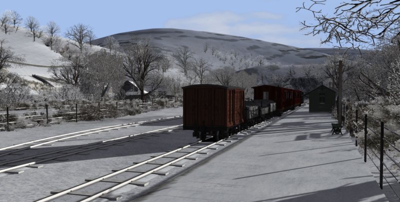
The route has full seasonality.
You can hear curlews, sheep, cattle and other rural sounds.
Daylight hours match the seasons with long summer days and long winter evenings. All the stations and villages have night lighting
Activities
The water tower at Hulme End has an animated hose but the other columns are static. However water points are interactive.
The route comes with a quick drive scenario in each direction. These use my narrow gauge consists that are available in the misc section here. There are no scenarios included – as yet…